

A Marrakech city map is most useful when it helps you make decisions on the ground: where to walk, where to take a taxi, which Medina gate to use, and when an attraction that looks close is actually better reached by car.
Think of Marrakech as two broad halves. The Medina is the historic walled city, where lanes, souks, riads and major monuments are concentrated. Outside the walls, Gueliz and Hivernage form the modern city. The Palmeraie is farther out and is not part of walkable central Marrakech.
For a wider overview of the city before choosing your base, see this Marrakech travel guide.
Marrakech city map: four zones at a glance
Use this overview for orientation rather than turn-by-turn directions. The Medina, Gueliz and Hivernage are adjoining central areas, but they do not function as one continuous walking zone. The Palmeraie is farther from the centre and normally requires road transport.

| Area | Position and character | Best way to move around | Useful anchors |
|---|---|---|---|
| Medina | Historic walled centre | Walk within each section; use taxis between distant gates | Jemaa el-Fnaa, Koutoubia, Ben Youssef, Bahia Palace, Kasbah |
| Gueliz | Modern city west and northwest of the Medina | Walk locally; use a taxi for cross-city journeys | Avenue Mohammed V, Place du 16 Novembre, railway station |
| Hivernage | Hotel and nightlife district southwest of Gueliz | Walk locally or use a taxi | Major hotels, restaurants and broad avenues |
| Palmeraie | Outlying palm-grove and resort zone north of central Marrakech | Taxi, hotel transfer or private driver | Resorts, golf courses and palm-grove properties |
Marrakech-Menara Airport is southwest of the central city, while Jardin Majorelle sits north of central Gueliz. A route that looks short on a screen may still involve heat, heavy traffic and uncomfortable road crossings.
For street-level locations, use the official Visit Marrakech maps together with a live navigation app. For airport arrival logistics, use the dedicated Marrakech Airport to Medina guide.
Table of Contents
Table of Contents
How to read a map of Marrakech without getting lost
The easiest way to navigate Marrakech is not to memorize every street. It is to learn a few large anchors and travel between them.
For first-time visitors, the most useful anchors are:
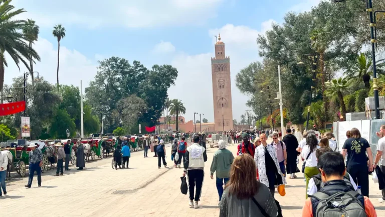
- Jemaa el-Fnaa: the practical centre of the Medina and the best starting point for understanding the souks.
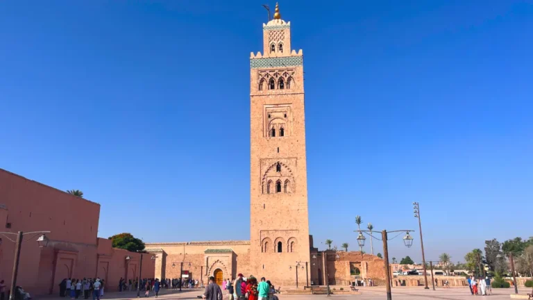
- Koutoubia: its minaret is visible from some open areas and helps confirm your direction near the square.
- Souk Semmarine: the broad, covered commercial route leading north from Jemaa el-Fnaa.
- Rahba Kedima: a useful Medina landmark beyond the first souk stretch.
- Ben Youssef area: a key northern Medina anchor.
- Bab Agnaou: the main gateway into the Kasbah area.
- Bab Doukkala: a useful northern Medina arrival and taxi point.
- Gueliz: the modern centre, oriented around Avenue Mohammed V and Place du 16 Novembre.
The golden rule is simple: learn Jemaa el-Fnaa and the route between your riad and its nearest accessible gate first. Once you can reliably return to those points, the Medina feels far less intimidating.
Medina orientation: the two routes that matter most
A street-by-street map is less helpful in the Medina than knowing two simple landmark chains. These are orientation routes, not compulsory itineraries.
Northern souks route
- Jemaa el-Fnaa
- Souk Semmarine
- Rahba Kedima
- Ben Youssef area
This is the easiest route for understanding the central and northern souks. Once you recognize this spine, short detours become less stressful because you know which direction leads back toward the square.
South-Medina route
- Jemaa el-Fnaa
- Riad Zitoun streets
- Bahia Palace and the Mellah
- El Badi Palace
- Kasbah, Saadian Tombs and Bab Agnaou
Group these southern sights together instead of crossing the Medina repeatedly. Check each monument’s official opening information before setting out, because access and ticket arrangements can change.
Where taxis can actually reach your Medina riad

A common Marrakech arrival mistake is giving a taxi driver only the name of a riad deep in the Medina. Many riads are inside pedestrian lanes where a car cannot reach the door.
Instead, ask your accommodation for:
- Its nearest vehicle-accessible drop-off point
- The closest Medina gate
- A saved map pin or written directions from that point
- Whether staff can meet you if you are arriving late or carrying heavy luggage
Useful taxi-access areas include:
- Bab Doukkala: often practical for northern Medina riads.
- Arset El Bilk and the vehicle-accessible edges around Jemaa el-Fnaa: often useful for central and southern Medina properties.
- Place Moulay Yazid: useful for the Kasbah and Saadian Tombs side of the Medina.
- Bab Agnaou: another useful point for the Kasbah area.
Do not assume that a drop-off beside Jemaa el-Fnaa is convenient simply because it is central. For a riad near Bab Doukkala or the northern souks, it may leave you with a long and confusing walk through busy lanes.
How to navigate the souks from Jemaa el-Fnaa

Jemaa el-Fnaa is the Medina’s most useful navigational starting point. Rather than immediately taking random turns, begin with a recognizable route:
- Stand with Jemaa el-Fnaa as your reference point.
- Enter the souks through Souk Semmarine.
- Continue north toward Rahba Kedima.
- Use the Ben Youssef area as your northern landmark.
- Return by retracing a main route before experimenting with side lanes.
This is not the only way through the souks, but it gives first-time visitors a reliable framework. Once you know this spine, smaller detours become less stressful because you know which direction leads back toward the square.
For shopping areas, what to buy and how to approach the experience, read the dedicated Marrakech souks and markets guide.
Why GPS is useful but not enough in the Medina
Digital maps can struggle in Marrakech’s narrow, covered and densely packed lanes. GPS drift can make it appear that you are on a parallel street when you are not. A route that looks simple on screen may involve a tiny passage, a busy covered souk or several similarly named lanes.
Use Google Maps or another navigation app as an aid, but do not treat it as absolute truth in the deepest Medina.
A better approach is to combine your phone with landmark-based navigation:
- Save your riad location offline.
- Save the nearest gate or taxi drop-off point separately.
- Screenshot the walking route from Jemaa el-Fnaa to your accommodation.
- Carry your riad’s business card or written address.
- Notice the large shops, mosques, squares and souk entrances on your return route.
- Ask your riad to explain the walk back on your first day.
A physical fold-out map or simple printed map is also useful when your phone battery is low or your screen is hard to read in bright sun.
Which Marrakech neighbourhood should you use as your map base?
Medina: best for riads, souks and historic atmosphere
The Medina is the right base if you want to step outside into old Marrakech: narrow lanes, traditional riads, markets and the main historic sights.
It is highly walkable once you understand your local area, but exact location matters. A riad near Jemaa el-Fnaa, Bab Doukkala, the Kasbah or the Mellah can offer very different arrival and walking experiences.
Choose the Medina if you value atmosphere and do not mind walking through lanes with limited car access.
Gueliz: best for straightforward streets and modern conveniences
Gueliz is Marrakech’s modern commercial and residential centre. Its major orientation line is Avenue Mohammed V, with Place du 16 Novembre as another useful landmark. The railway station is on the Gueliz side of the city rather than inside the Medina.
Gueliz suits travelers who want:
- Easier taxi and vehicle access
- Modern cafés, restaurants and shops
- Simpler street navigation
- A more conventional city layout
- Easy access to the railway station
It is not the same experience as sleeping in a Medina riad, but it is often easier for travelers who dislike carrying luggage through narrow lanes.
Hivernage: best for hotels, nightlife and wide roads
Hivernage is distinct from Gueliz. It is a quieter, more upscale hotel and nightlife district with broad roads and easy taxi access.
It suits travelers prioritizing larger hotels, dining, nightlife and a smoother vehicle-based stay rather than an old-Medina atmosphere.
Before planning an evening here, see my Marrakech nightlife guide for the different nightlife areas, dress expectations, club timing and late-night taxi advice.
Palmeraie: best for resort stays, not central sightseeing
The Palmeraie is a separate outlying palm-grove zone, several kilometres beyond central Marrakech. It should never be treated as part of a walkable city-centre itinerary.
A Palmeraie resort can work well for a relaxed, resort-style stay, but expect to use a taxi, private transfer or other road transport for Jemaa el-Fnaa, Gueliz, Jardin Majorelle and most sightseeing.
For a neighborhood-by-neighborhood comparison, see my guide to where to stay in Marrakech.
When to walk and when to take a taxi
A good Marrakech map helps you avoid false economy. Walking is free, but a long, hot or traffic-heavy route can cost you time and energy that is better spent enjoying the city.
Walk these areas
Walking is natural and practical for:
- Jemaa el-Fnaa, the central souks and nearby Medina sights
- The route between Souk Semmarine, Rahba Kedima and Ben Youssef
- The Mellah, Bahia Palace, El Badi Palace and Kasbah zone as one south-Medina circuit
- Central Gueliz, especially around Avenue Mohammed V and Place du 16 Novembre
- Parts of northern Gueliz to Jardin Majorelle, if you are comfortable walking and conditions are pleasant
Use taxis strategically for these connections
A taxi is generally the more practical choice for:
- The Medina to Jardin Majorelle, especially in warm weather
- Airport to your accommodation
- Central Marrakech to the Palmeraie
- Long cross-city routes when you have limited time
- Late arrivals with luggage
- Travel between a resort or hotel district and the Medina
The city is compact enough to feel close on a map, but sun, road crossings, traffic and the lack of direct pedestrian routes can make a journey far less pleasant than it appears.
A sensible one-day and two-day map plan
One day: keep the route compact
For a first day, concentrate on central and northern Medina rather than trying to cross the entire old city several times.
- Begin around Koutoubia and Jemaa el-Fnaa.
- Enter the souks through Souk Semmarine.
- Continue toward Rahba Kedima.
- Finish around the Ben Youssef area.
- Return toward Jemaa el-Fnaa by a main route you now recognize.
If the southern palaces and Kasbah are your priority, use the south-Medina route instead. Do not combine both routes unless you are comfortable with a long walking day.
Two days: divide Marrakech geographically
Day 1: Explore one Medina route properly. Choose the northern souks and Ben Youssef area or the Mellah, palaces and Kasbah circuit.
Day 2: Visit the other Medina zone, or use a taxi to combine Jardin Majorelle with Gueliz and Hivernage. Keeping distant districts separate reduces unnecessary backtracking.
For a complete sightseeing plan rather than navigation alone, use my guide to the best things to do in Marrakech.
Stay safe and confident in the lanes
Marrakech’s Medina is lively and manageable, but it rewards calm, predictable navigation.
Be cautious with unsolicited route “help”
Not everyone offering directions has bad intentions, but be wary when someone insists that a street, monument or route is “closed” and immediately offers to lead you elsewhere. Sometimes this is used to steer visitors toward a shop, request a tip or sell an unofficial guiding service.
A polite refusal is enough. If you are unsure, verify with:
- Your riad
- A nearby shopkeeper
- Police or tourism authorities
- A licensed guide
- Another reliable local source
Remember that pedestrian-looking lanes may have traffic
Medina lanes are not always pedestrian-only. Scooters, motorcycles, bicycles, handcarts and delivery traffic can appear suddenly, including in narrow shopping passages.
Walk predictably, keep children close and move aside when vehicles approach. Avoid stopping abruptly in the middle of a lane to check your phone.
Keep night routes simple at first
During your first nights, use familiar, active and reasonably lit routes—particularly between Jemaa el-Fnaa and your accommodation. Avoid testing deep residential alleys late at night just because they appear to be a shortcut on a map.
Ask your riad to show you the best return route on arrival. That small briefing can make your first evening much easier.
The simplest way to make Marrakech feel navigable
Do not navigate Marrakech as if it were a grid city. The Medina becomes much easier once you stop trying to memorize every alley and instead move between major anchors.
Learn:
- Jemaa el-Fnaa
- Your riad’s route from the nearest accessible taxi point
- Your closest Medina gate
- One main souk route north toward Rahba Kedima and Ben Youssef
- The south-Medina link between the Mellah, palaces and Kasbah
Save those points offline, keep your accommodation details with you and explore one geographic zone at a time. That is the practical Marrakech map system most visitors need.
FAQ
What is the best starting point for navigating the Marrakech Medina?
Jemaa el-Fnaa is the best practical starting point. From there, use Souk Semmarine, Rahba Kedima and the Ben Youssef area as your main northern landmarks.
Can taxis drive directly to riads in the Marrakech Medina?
Often not. Many riads are inside narrow pedestrian lanes. Ask your riad for its nearest vehicle-accessible drop-off point before arrival, rather than giving the driver only the accommodation name.
Is Jardin Majorelle walkable from the Medina?
It is possible for confident walkers, but it is not always pleasant because of heat, traffic, road crossings and distance. A taxi is generally the more practical option from the Medina, especially in warm weather.
Is the Palmeraie close enough to walk from Jemaa el-Fnaa?
No. The Palmeraie is a separate outlying area beyond central Marrakech and generally requires taxi, private transfer or other road transport.
Can I rely on Google Maps in the Marrakech souks?
Use it as a backup, not as your only navigation tool. GPS can drift in narrow or covered lanes, so combine offline maps with landmark-based navigation and saved riad directions.